If nothing else, yesterday was an adventure.
I wanted to go hiking. “We don’t hike enough,” I said. “Let’s go hiking.” Kyle nodded behind his laptop. “Okay,” he said,” figure out where you want to go.” So together, Google and I found Crane Mountain. I didn’t want to hike it; I mean, it’s only a 4ish mile loop, and only 1,200′ ascent. Which half the distance and 2/3rd the height of our usual climbs. But we’ve climbed damn-near everything else in the Lake George area (the closest major hiking mountains to our house) that isn’t largely occupied by rattlesnakes this time of year, so Crane it was.
And of course, just for funsies, we planned to tackle the three caches on the mountain. One 1/4 mile up the trail, one at the summit, and a multi cache (the first cache contains the coordinates for the second and second, coordinates for the third and final cache) that started just after the summit on the trail down. All three seemed to spell out where they were hidden in detail; I suppose the cache operators figuring that the hike up made them challenging enough without hiding them anywhere insane. A little planned fun to break up the hike.
So with backpacks full of water and a Swag Bag full of friendship bracelets, we set off. I figured we’d be done by lunchtime.
Wrong.
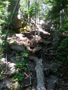
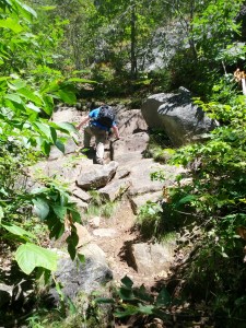
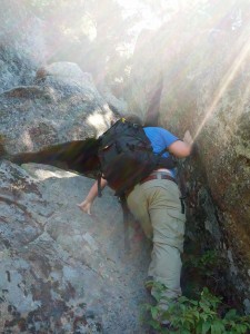
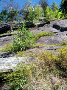
Now, most of our hikes start out slow. The first mile or so will be pretty easy, a wide, flat trail that slopes up gently, before it takes off. Not Crane. Crane don’t fuck around. This mountain has been highly eroded, leaving a narrow path of exposed roots and rocks. Which left us standing at the bottom of passes like this:
And this:
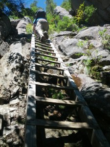
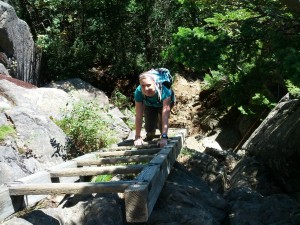
There were even two points on the mountain where someone long ago was forced to haul 2x4s up the mountain and construct ladders to help hikers get up some nastier parts.
So, yeah, the mountain kicked our asses.
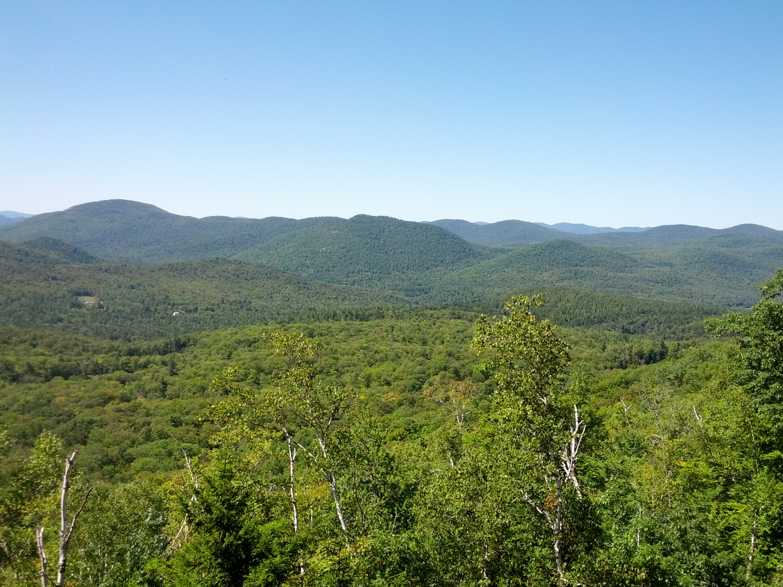
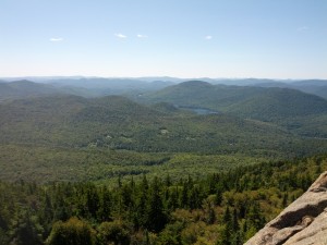
But despite the fact that my legs were jelly by the time we got back to the car and I’m not moving particularly fast today, it was actually a pretty fun hike. Much of the trail was exposed, providing endless opportunities for breathtaking views.
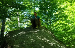
And the path was lined with tons of enormous boulders, which offered countless things to scramble up and climb on top. And who doesn’t love climbing up on big things?
(Well, I like to climb up on big things. Also my cat, but she’s limited to our dresser and the fridge.)
The first two caches were a bust. Needless to say, I was wicked disappointed. I mean, you don’t hike up a mountain looking for caches and shrug when they come up missing. But in both cases I could see what had likely happened. The first, only a short ways up the mountain, should have been hidden in a small opening between two rocks about 110′ up a fairly steep slab of rock. It’s easy to see how one bump from a wild animal seeking shelter could have sent the cache tumbling down the mountain.
The second cache was at the summit, in the remains of the old fire tower. Past finders talked about how easy of a find it was, often left out in the open, but we saw neither hide nor hair of it. What we did find, however, were garbage (not cool) and recent campfire remains (super not cool) not 15′ from what looked like the original hiding spot. And I’m just saying, if you’re the kind of jackass who will build an illegal campfire and leave your empty Keystones at the summit of a mountain, I wouldn’t put it past you to be the kind of jackass who would fuck with the metal box you found lying next to your campfire.
Speaking of the summit…
Pretty fucking cool, eh?
I will never stop being amazed by the fantastic views from the top of the Adirondack mountains.
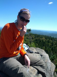
At the top we had a quick lunch of pb&j, trail mix, and dried chickpeas.
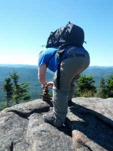
We looked around for the cairn (small pile of rocks hikers can add to that indicates the summit) and were surprised when we didn’t see one. So we made our own.
And then it was time to head back down. We chose to take the trail down the back of the mountain, partially because route promised to be slightly longer and flatter (a relative term, we would soon learn,) as well as a lovely view of a mountain pond but also because this was the route that the multi-cache had us take.
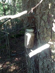
We made our way down the back, which would prove to be just as rocky and precarious as the front of the mountain, and to the pond. Along the way we found the first two parts of the multi, nice little caches maybe 25′ off the trail and right on the coordinates.
As we stood next to the mountain pond, we took a few minutes and consulted the newest set of coordinates against the route suggested by the cache operator before continuing down the mountain trail. But a couple hundred feet down the trail, I stopped. Something didn’t feel right. The path back to the trail head was continuing down to our left, but the arrow on my GPS was pointing steadily to my right. If our coordinates were right, (and they were,) we were going to have to go almost a half mile out of our way, which was odd considering both the previous stages of the cache were right on the trail. And the notes in the cache description make it very clear that you should go counterclockwise around the lake, NOT clockwise, but here we were going clockwise around the pond. Others who had gone the wrong way around the pond had been forced to “bushwhack” (a term that it means exactly what it sounds like) for quite a distance, and I wanted to avoid the same fate.
I think we can all see where this is going.
So we turned around and headed the other direction, following a faint water trail back past our original spot by the pond and on for another few hundred feet, until suddenly the trail dropped off. We technically could have scaled it the 110ish’ down, but there didn’t appear to be any kind of trail at the bottom, and nothing but solid forest ahead. As we peered down the rocks, it didn’t feel right.
See, there’s a kind of trust that is established between cachers and the cache operators. We have to trust that by going after this cache, we’re not going to be forced to do anything illegal, to trespass on anyone’s property, or to do anything that would threaten our lives or safety. (At least without warning us first!) And this didn’t feel right. In my heart of hearts, I couldn’t believe that the cache operator would have us climb down something so precarious and push through forest so dense. It was possible that there was a trail below us, but it didn’t look likely. It just didn’t feel right.
So Kyle took another look at his Garmin and noticed that there’s a second path that runs counterclockwise around the pond towards the region of the cache. Despite the warnings from the operator, this seemed like a more likely possibility, so we set off, back past that spot by the pond again and onto the second trail. Luckily this trail wasn’t so rocky, more of a normal forest trail, so we were able to move quickly.
But as we rounded the far side of the pond, the trail got fainter and fainter. Before long, we were no longer following a trail so much as following the arrow on the GPS and choosing the path of least resistance. And soon after we weren’t even able to do that, instead forcing our way through the trees and brush. And climbing. Without noticing, the GPS had been slowly leading us up another peak. Already exhausted and legs shaking, we forced our way through thick pine and slippery lichen, branches clawing our faces and arms with every step. The thought of turning back crossed my mind more than once, but the thought of enduring what we’d already done seemed just as impossible so we kept moving forward.
Finally, after what seemed like an eternity, we popped out at the summit of a nearby peak. I suppose we should have stopped to enjoy the view, but by then we were sweaty, dirty, exhausted, and over it. Stumbling the last 50′, the cache was hidden so obviously that I didn’t even have to search. In no time I had the cache in hand, but the victory was overshadowed by my aching feet and the bitterness over being tricked into climbing another goddamn mountain.
Fucking fuck.
By now, it was later than we intended. We still had two hours to sunset, but we were now standing on top of a mountain about a mile and a half from our car. We needed to get down, and quick. The cache description had made mention of an “informal path” that would take a person to this peak, but we just couldn’t find it. So we just went for it.
The way down was not nearly as arduous as the climb up. This time we were able to follow another water trail that avoided the thickest of the forest, and before long we’d joined back up with our original trail. Now all that was left was the rest of the slow hike down the rocky mountain path.
No problem.
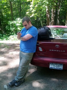
Eventually we saw the blessed sight of our beautiful little piece of shit car. We’d beaten sunset by about 30 minutes. As we drove towards home and takeout wings, we couldn’t help but reflect that except for the detour to the final cache, it had actually been a really fun hike. Challenging, yes; we both had our asses handed to us. But it was a fun ass handing.
Like I said, it was an adventure.



The mountain I got lost on a few years ago
The mountain I got lost on a few years ago
The mountain I got lost on a few years ago
You are such a badass. I’m glad I never blogged about my hiking experience in Arches, because you would have laughed and vowed never to be in nature with me.